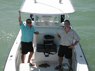
By Jon Fajans, SEAKEYS Program Manager & Andrew Crowder, SEAKEYS Research Assistant
SEAKEYS, which stands for Sustained Ecological Research Related to the Management of the Florida Keys Seascape, is a research framework for scientists organized by the Florida Institute of Oceanography (FIO) in 1989, with funding from the John D. and Catherine T. MacArthur Foundation. Keys Marine Lab provides the SEAKEYS program a base for its operations. As part of SEAKEYS, FIO, in cooperation with the National Data Buoy Center (NDBC), established six enhanced Coastal Marine Automated Network (C-MAN) environmental monitoring stations. The program is now sustained annually through grants from NOAA and the EPA.
Renovated SEAKEYS building at KML (formerly the Conch Lab)

The SEAKEYS C-Man stations, located throughout the Florida Keys and the Bay, provide a wealth of oceanographic and weather data used by marine ecosystem managers and scientists conducting research. Scientists investigating topics like coral bleaching and algae blooms are not the only people that depend upon the real-time data provided by the oceanographic stations. Boaters, anglers, and divers, including commercial operators, also take advantage of being able to check the wind speed and direction on the internet before they leave the dock.
C-man station LONF1 Florida Bay north of Long Key
The SEAKEYS network encompasses the geographic scale of the Florida Keys and the Dry Tortugas. The data is transmitted hourly via a Geo-stationary Orbiting Environmental Satellite (GOES) providing near real-time environmental baseline data for researchers, resource managers, and the public. These stations record hourly wind speed, wind direction, air temperature, barometric pressure, sea temperature, salinity, and terrestrial solar irradiance. These data are available on the web at the following sites: http://www.ndbc.noaa.gov/maps/Florida.shtml and http://www.coral.noaa.gov/seakeys/real_data.shtml.
A seventh monitoring station, a cooperative effort between FIO and the University of South Florida's Coastal Oceanographic Monitoring Program (USF/COMPS), is located in Northwest Florida Bay. This site has been down since hurricanes Katrina and Wilma destroyed the monitoring equipment and is expected to be back online fall 2008. Upon completion this data will also be available by visiting:http://comps1.marine.usf.edu/nfb/index.shtml or one of the websites listed above.
In addition to the rebuilding of the station in Florida Bay, this year the SEAKEYS Program began upgrading all of their stations throughout the Keys to process at a high data rate to accommodate a new suite of sensors that will greatly enhance the data. The oceanographic sensors that will be at all seven monitoring stations are a Falmouth Scientific NXIC-CT sensor, that measures water conductivity, temperature, salinity, and can power up to five other sensors, a Biospherical PAR sensor, which will show the amount of biologically productive light reaching the water that is important for coral growth, and a Falmouth Scientific 1-D wave sensor, that will give tide information and wave heights. Also, there will be Solar Light underwater UVB sensors at Fowey Rocks (FWYF1), Molasses Reef (MLRF1), Sombrero Reef (SMKF1), Sand Key (SANF1), and Pulaski Shoal (PLSF1) which will cover the entire Sanctuary reef tract. UVB rays from the sun are important for photosynthesis in the symbiotic algae found in coral tissues. MLRF1 will also get CO2 and pH sensors for a closer look at the impacts of global climate change on the reefs of the Florida Keys.
In the near future SEAKEYS will also be adding their first buoy creating an eighth station off of Carysfort Reef thanks to a generous contribution from the Ocean Reef Foundation. This station (CRYF1) is a YSI buoy that is over ten feet tall and will be replacing one of the corner buoys of the Sanctuary Protected Area (SPA) at Carysfort Reef near the Gulf Stream. Along with the standard oceanographic and meteorological data that the other SEAKEYS stations provide, the buoy will be equipped with a new Falmouth Scientific 3-D wave sensor that will not only give wave height and direction, but current direction and speed also. In addition, this sensor will provide water clarity readings which will be helpful to the anglers and divers of the Upper Keys. The SEAKEYS staff hopes that this cutting edge science will be well received by the public, which may lead to funding opportunities that would allow them to apply this technology to other locations throughout the Keys, such as deep water wrecks for added dive safety.
For more information about this program visit: http://www.keysmarinelab.org/seakeys.htm
Or contact the program manager at: jsfajans@keysmarinelab.org


No comments:
Post a Comment